🗺 Open the 3D map of Suita Expo '70 Park guide → Stations → Plan your day →
Key facts
| Name | Suita (吹田市). How the name came about is in History of Suita |
| Location | Northern Osaka Prefecture (the Hokusetsu area). Osaka City to the south, Toyonaka to the west, Minoh to the north, Ibaraki and Settsu to the east |
| Area | 36.09 km² (6.3 km east–west, 9.6 km north–south) |
| Population | 385,857 (end of Feb 2026, resident register), growing almost every year since 1995 |
| City status | Founded 1 April 1940 from four towns and villages; a core city since April 2020 |
| Transport | JR, Hankyu, Osaka Metro, Kita-Osaka Kyuko and Osaka Monorail: 15 stations. Suita interchange on the Meishin and Chugoku expressways |
| Universities | Osaka University (Suita campus), Kansai University and others. 48,699 students, the most of any municipality in Osaka Prefecture |
| Parks | 326.71 ha of urban parks, including Expo '70 Commemorative Park and Hattori Ryokuchi |
Areas and their character
- Expo '70 Park and EXPOCITY (north-east): the sightseeing centre. Tower of the Sun, Japanese Garden, National Museum of Ethnology (Minpaku), EXPOCITY with the NIFREL aquarium, Panasonic Stadium Suita. Osaka Monorail Banpaku-kinen-koen Station → Expo '70 Park guide
- Esaka (south-west): four stops from Umeda on the Osaka Metro Midosuji Line. An office district with the most restaurants in the city → Eat & drink
- Around JR Suita and Hankyu Suita stations (south): city hall, shopping streets and the birthplace of Asahi Beer. Home of citizens' events such as the Suita Autumn Festa in October
- Senri New Town (north): Japan's first large-scale new town, occupied from 1962. Minami-Senri, Kita-Senri, Momoyamadai. Greenery and housing estates
- Senriyama and Kandai-mae: residential streets along the Hankyu Senri Line and the Kansai University student quarter
- Kishibe and Kento (east): the Kita-Osaka Health and Biomedical Innovation Town in front of JR Kishibe Station, with the National Cerebral and Cardiovascular Center and the municipal hospital
Stations and getting around
- JR Kyoto Line: Suita and Kishibe (Suita is three stops from Osaka Station) / JR Osaka Higashi Line: Minami-Suita (opened 2019)
- Hankyu Senri Line: Suita, Toyotsu, Kandai-mae, Senriyama, Minami-Senri, Yamada, Kita-Senri
- Osaka Metro Midosuji Line: Esaka / Kita-Osaka Kyuko: Momoyamadai
- Osaka Monorail: Yamada, Banpaku-kinen-koen, Koen-higashiguchi (for the park, EXPOCITY and the stadium)
All 15 stations → Getting to Expo '70 Park → Transit passes →
Sights worth the trip
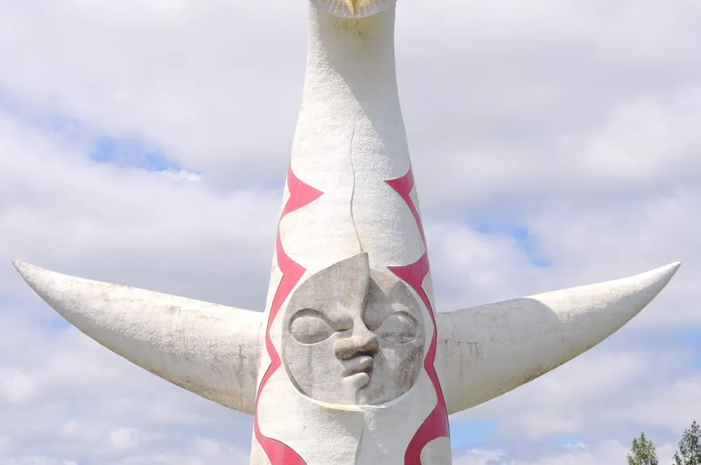
- Tower of the Sun (Taro Okamoto, 1970; a national Important Cultural Property since 2025): the interior tour needs a booking → Tickets and booking
- Expo '70 Commemorative Park: Natural and Cultural Gardens, Japanese Garden, cherry blossoms in spring, autumn leaves, National Museum of Ethnology → Autumn leaves guide
- EXPOCITY: the large complex next to the park, with the NIFREL aquarium, shops and restaurants
- Panasonic Stadium Suita: home of Gamba Osaka → Match-day guide
- Ramen, sushi and yakiniku, mostly around Esaka → Ramen / Sushi / Yakiniku
Plan your day → Where to stay →
Events through the year
| Spring | Cherry blossoms in Expo '70 Park. The Gamba Osaka season runs from February to December |
| August | Summer Sonic Osaka in Expo '70 Park → Guide |
| October | Suita Autumn Festa around JR Suita Station. Rose Festa in Expo '70 Park |
| November | Autumn leaves, the Expo fireworks and the start of Ramen EXPO → Ramen EXPO guide |
| December | Ramen EXPO (until 30 December) and projection mapping on the Tower of the Sun |
Suita as a place to live and study
- About 60% of residents say they want to keep living where they are (2022 citizen survey)
- 2,516 doctors and 15 hospitals (20 beds or more). Ambulances reach the scene in 6 min 49 s on average (national average 9 min 48 s)
- 0.96 fires per 10,000 residents (national average 3.1)
- 48,699 university students, the most of any municipality in Osaka Prefecture
- 96,078 people commute into Suita and 110,621 commute out (2020 census)
Convenience stores → History of Suita →
Frequently asked questions about Suita
How do you pronounce Suita?
SUI-ta (吹田). The city's official view is that it comes from Sukita, a place name recorded in the 8th century, which shifted in sound to Suita.
Where is Suita, and how far from Osaka Station?
In northern Osaka Prefecture, directly north of Osaka City. JR Suita Station is three stops from Osaka Station on the JR Kyoto Line; Esaka is four stops from Umeda on the Osaka Metro Midosuji Line. For Expo '70 Park, use Osaka Monorail Banpaku-kinen-koen Station.
Is Suita safe?
By the city's published figures, the fire rate is less than a third of the national average (0.96 per 10,000 residents), ambulances arrive about three minutes faster than the national average, and around 60% of residents say they want to stay. It is a quiet residential city.
Which areas are popular to live in?
The green Senri New Town (Minami-Senri, Kita-Senri, Momoyamadai), Senriyama along the Hankyu line, and Esaka for its quick link to Umeda. See the areas section above.
How much time do I need for sightseeing?
Half a day to a full day for Expo '70 Park (Tower of the Sun, Japanese Garden, Minpaku) and EXPOCITY. On a Gamba Osaka match day or during Ramen EXPO, combine them. See Plan your day.
Was Expo 2025 held in Suita too?
No. Expo 2025 was on Yumeshima in Osaka City. Suita's Expo '70 Commemorative Park is the site of the 1970 World Expo, and the Tower of the Sun is its symbol.